
Valle del Arcoiris Atacama: The Truth About Rainbow Valley That GPS Won't Tell You
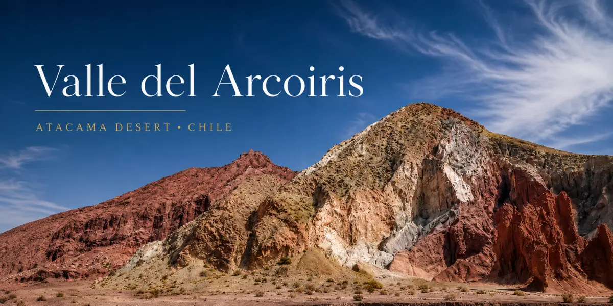
If you type “Valle del Arcoiris” into Google Maps and think that’s enough — I thought the same thing.
The truth is GPS gets you to the gate. After that, you’re on your own in a desert with no signal, no signs, and nobody to ask — except for one tour bus that happened to be parked right there.
This is everything I wish I’d known before the drive: the real route, the mistakes I made, and what made this the best day of the entire Atacama trip.
If you haven’t booked accommodation in San Pedro de Atacama yet, sort that first at trip.com — every single day trip in Atacama starts from here.
What to Prepare Before Leaving San Pedro for Valle del Arcoiris
- Download offline maps before leaving town — there’s zero signal on the entire route. Maps.me or Google Maps Offline both work. Even with Airalo eSIM, there are no cell towers out there, so screenshot your route before you go.
- 4×4 vehicles only — the road is unpaved gravel. A low-clearance car won’t make it. Book at DiscoverCars / Rentalcars.
- At least 2 liters of water per person — the desert air is bone dry and dehydration sneaks up on you. An insulated water bottle keeps things cold all day (Shopee: here).
- SPF 50+ sunscreen — at 3,200–3,500m elevation, UV radiation is significantly stronger than at sea level. Apply before getting out of the car. Amazon / Shopee.
- Closed-toe shoes — sand, sharp rocks, and thorny plants. Sandals are a bad idea.
- Chilean pesos in cash — entrance fee is around $5 USD. No card payments accepted.
Self-Driving to Valle del Arcoiris: The Route
Distance: ~90 km from San Pedro | Drive time: ~1–1.5 hours | Route: CH-23 heading southeast through Toconao
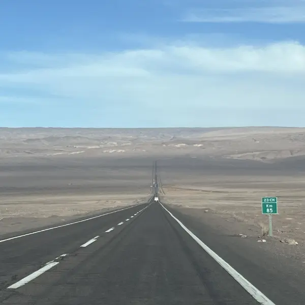
I left early in the morning. The road out of San Pedro starts off fine, but once you pass Toconao the surface switches to gravel immediately — dust everywhere, rocks bouncing off the undercarriage, speed dropped right down.
Both sides of the road are pure desert as far as you can see. No trees, no buildings, no people. But halfway through, I spotted something unexpected: a donkey just walking along the road, completely unbothered by the car, strolling through the desert like it owned the place.
Don’t want to self-drive? Book a guided Rainbow Valley tour at GetYourGuide — transport and guide included.
Arrived at the Gate — But Where Was the Rainbow Valley?
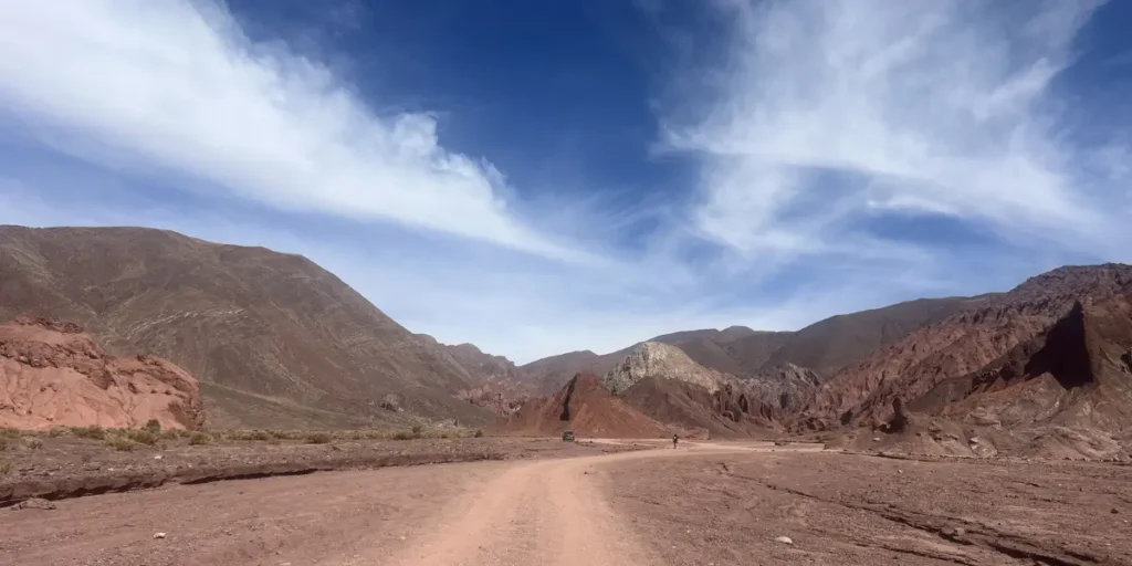
The entrance checkpoint had a ranger. Paid the fee, listened to directions in rapid Spanish, nodded like I understood, then drove in.
My plan: just keep driving, signs will appear.
No signs appeared.
I hit a fork and picked a direction. Drove further. More desert. Nothing. No marker, no arrow, no indication of which way the colorful mountains were.
Just emptiness.
Then I spotted a tour bus parked off to the side. That was the first real sign I was heading the right way.
How I Found Rainbow Valley: Follow the Tour Group
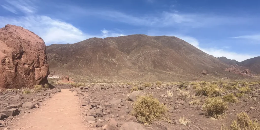
I parked and walked over to a tour guide leading a group nearby. He was genuinely kind — pointed me in the right direction and said I could follow along.
I blended in with the group for the first stretch. Once I could see the path clearly marked by small rocks laid out in a line, I broke off and explored on my own.
Those small rocks are the only trail markers in Valle del Arcoiris. Stay between them — not because it’s dangerous to stray, but because some areas have fragile mineral layers that can be damaged by foot traffic.
Practical tip: If you’re self-driving and can’t find the trail, just wait for a tour vehicle. They come through daily, and guides are usually happy to point you in the right direction.
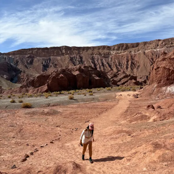
The Real Story of Rainbow Valley: Million-Year Geology on Display
Before arriving, I pictured “rainbow mountain” as something with seven distinct colored bands like an actual rainbow.
That’s not what it is — and it’s more interesting than that.
Valle del Arcoiris is an open-air geological museum built over millions of years. The colors come from mineral deposits left behind by ancient volcanoes:
- Red/brown → iron oxide that oxidized over time
- Green → volcanic ash and silicate minerals
- White → salt and gypsum deposits
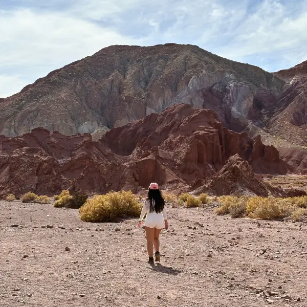
Think of it as the earth’s own record-keeping system. Each color band is a different chapter in the history of this landscape. Long before this was a desert, it was volcanic terrain — and time painted it one layer at a time.
No seven-color rainbow. But something better: a landscape that’s genuinely unlike anything else on the planet.
Rio Grande Trail and the Plants You Should Not Touch
From the main viewpoint, the path descends into Rio Grande — a walk between two tall rock walls, each side showing different mineral layers: rust red, pale green, chalky white, alternating as you move through.
It’s quieter than the viewpoint. Feels like walking directly through the geology itself.
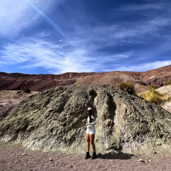
One warning from personal experience: the desert plants here have seriously sharp thorns. They look like ordinary dry-climate shrubs but grab one without thinking and the spines go straight in. It hurts enough to make you flinch hard. Learned that the free way.
Don’t touch the plants.
Slot Canyon Atacama: The Best Part at the Very End
Keep walking to the end of the trail and you’ll reach Slot Canyon — a narrow gap between two high rock walls that squeeze closer together the further in you go.
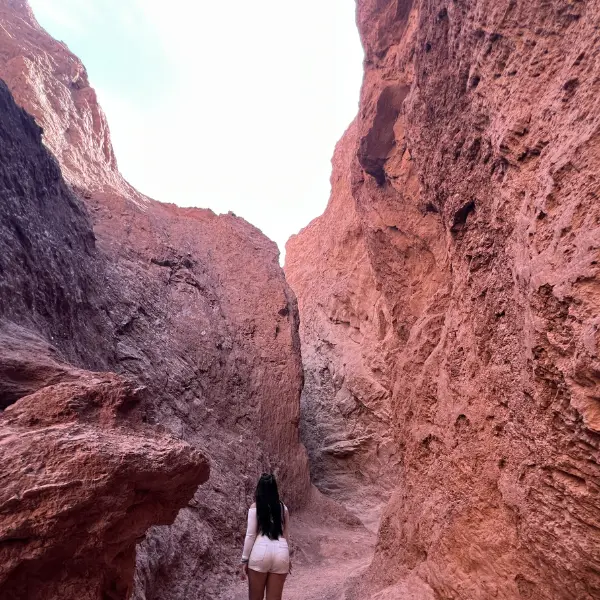
Early on it’s wide enough to pass someone coming the other way. Deeper in, it narrows to single-file. At some points you’re turning sideways to move through.
It feels like standing at the bottom of a crack in the earth. Looking up, you see just a thin strip of deep blue sky between the walls on either side.
The rock is hard and sharp — a few edges looked like they could cut. Don’t lean against the walls without checking first.
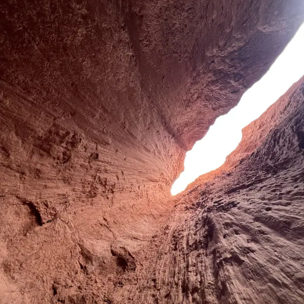
But the view looking straight up from the bottom is something else. Tall red-brown canyon walls against a deep blue sky. Photos don’t fully capture what it actually feels like to stand there.
Bonus: A Vicuña on the Road Back
I ran out of time before covering every trail. Valle del Arcoiris has more paths to explore if you give yourself a full day. But I had to head back to town.
Then, halfway back, something stepped out onto the road.
A Vicuña — standing maybe 20 meters from the car, completely calm. Not running. Not nervous. Just walking along, totally unbothered.
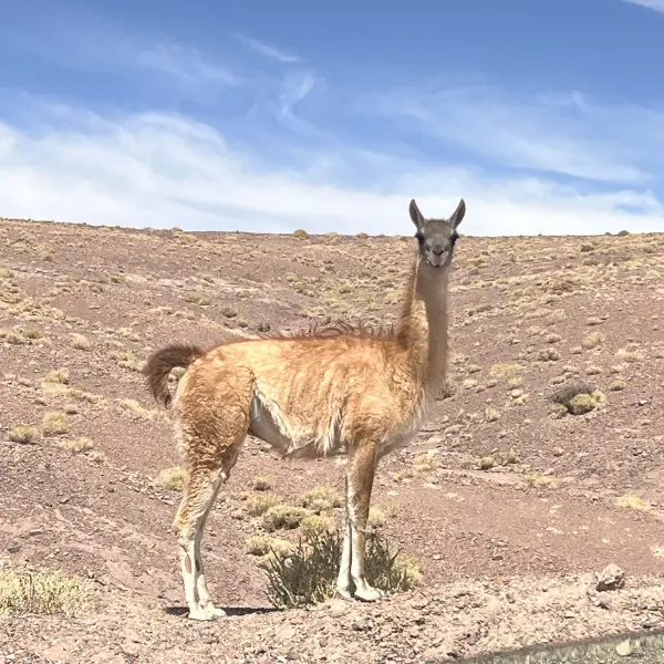
Vicuña are different from the llamas and alpacas you see at tourist markets. Smaller build, longer legs, and far rarer in the wild. They’re a protected species in Chile. Their wool is the most expensive natural fiber in the world — finer than cashmere — and historically was reserved exclusively for Incan royalty.
Seeing one up close in the wild? Pure luck. That made the whole day.
Valle del Arcoiris Atacama: Quick Facts
| Detail | Info |
| Distance from San Pedro | ~90 km |
| Drive time | ~1–1.5 hours |
| Entrance fee | ~$5 USD (cash only) |
| Elevation | 3,200–3,500m |
| Time needed | Half day (3–4+ hours) |
| Best light | Morning, 7:00–8:30 AM |
| Cell signal | None on the route |
Useful links for this trip:
- 🚗 Rent a 4×4 in Atacama — DiscoverCars
- 📱 Airalo eSIM Chile — works in town and on main roads
- 🏨 Where to stay in San Pedro de Atacama — trip.com
- ☀️ SPF 50+ Sunscreen: Amazon / Shopee
- 💧 Insulated Water Bottle: Amazon / Shopee
- 🗺️ Rainbow Valley Guided Tour — GetYourGuide (if you’d rather not drive yourself)
FAQ — Valle del Arcoiris Atacama
Q: How do I get to Valle del Arcoiris from San Pedro de Atacama? A: Drive southeast on Route CH-23 for about 90 km, passing through Toconao. The drive takes 1–1.5 hours. A 4×4 vehicle is strongly recommended — the road is unpaved gravel. Book a rental here.
Q: Why does Rainbow Valley have so many colors? A: The colors come from mineral deposits left by ancient volcanoes. Red and brown from iron oxide, green from volcanic ash, white from salt and gypsum. It’s geology, not paint — and it took millions of years to build.
Q: Can I visit Valle del Arcoiris without a tour? A: Yes, but download offline maps before you leave San Pedro — there’s no cell signal and no trail signs after the entrance gate. If you’d prefer a guide, this tour covers transport and navigation.
Q: Where is the Slot Canyon in Valle del Arcoiris? A: At the very end of the main trail. Walk past the rainbow mountain viewpoint, through Rio Grande, and continue to the end. From the gate, allow 30–45 minutes of walking to reach it.
Q: What is a Vicuña and can I see one in Atacama? A: Vicuña are wild South American camelids with the world’s most expensive natural fiber. They’re a protected species in Chile and can be spotted in high-altitude areas of Atacama. Sightings aren’t guaranteed — I got lucky on the drive back.
Q: How much does it cost to enter Valle del Arcoiris? A: Around $5 USD or equivalent in Chilean pesos. Cash only — no card payments accepted at the gate.
Q: How long should I spend at Valle del Arcoiris? A: At minimum 3–4 hours to cover the main viewpoint and Slot Canyon. A half-day gives you room to explore more trails without rushing.
*This post contains affiliate links. If you purchase through these links, I may earn a small commission at no extra cost to you.